Geosyntec Consultants Logo

USA

Full-Scale Bioremediation of Chlorinated Solvents in Groundwater at Six Sites

2026-04-06T11:36:38-06:00October 27th, 2009|Tags: , , , |

The Aberdeen Area at Aberdeen Proving Ground (APG-AA) has operated as an ordnance proving ground since 1917, and throughout its history has been the site of testing of conventional weapons, ammunition, armored vehicles, and other equipment. During a previous Remedial Investigation, chlorinated solvents were identified in groundwater at six sites within APG-AA, collectively known as Other Aberdeen Areas (OAA). The primary contaminant of concern at all six sites is trichloroethene (TCE); however, 1,1,1-trichloroethane (1,1,1-TCA) has also been identified at some sites. The Army's objective for the OAA sites was to rapidly identify, design, build, and implement cost-effective remediation systems that will meet interim remediation goals within five years and drinking water standards within 30 years.

Preliminary TMDL and Nonpoint Source Pollution Assessment of Coastal Areas in Southern Massachusetts

2026-06-16T14:30:14-06:00October 27th, 2009|

Section 303(d) of the Clean Water Act requires states to list water bodies as "impaired" if they do not meet one or more of a defined list of water quality standards. It also requires the states to determine Total Maximum Daily Loads (TMDLs) for the pollutant(s) in each impaired water body that are contributing to the impairment. TMDLs determine the amount of a pollutant that a water body can safely handle without violating water quality standards.In 2001, the Massachusetts Department of Environmental Protection (MassDEP) classified 32 ponds and stream segments as "impaired" under Section 303(d) in the towns of Plymouth, Kingston, and Pembroke in southeastern Massachusetts. These towns fall within the state's South Coastal watershed. Many of these water bodies were impaired due to noxious aquatic plants, but other pollutants included metals, turbidity, bacteria, and nutrients.The regional watershed coordinator with the MassDEP for the South Coastal watershed identified the need to conduct a further investigation of the 32 listed water bodies to assess the nature of the pollution problems and to identify which water bodies were in most need of attention.

Pilot Test Evaluation of Emulsified Zero-Valent Iron for Chlorinated Solvent Source Zone Remediation at NASA KSC LC 34

2026-04-06T13:20:52-06:00October 27th, 2009|Tags: , , |

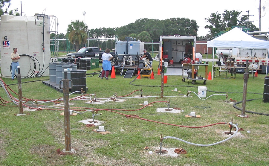
NASA's Launch Complex 34 (LC-34) at Cape Canaveral Air Force Station was used for Saturn rocket launches between 1959 and 1968, and is the site of historic releases of trichloroethylene (TCE) used for rocket maintenance activities. It is estimated that up to 88,000 lbs. of TCE are present in the aquifer below LC-34 as a dense, non-aqueous phase liquid (DNAPL), suggesting that restoration of the aquifer through natural remediation processes would take decades. NASA has a strong interest in evaluating and implementing cost effective methods for accelerating in situ remediation of the TCE at this and other site.

Temporary Excavation Design for expansion of Memorial Hermann Heart and Vascular Institute

2026-04-06T13:01:25-06:00October 27th, 2009|Tags: |

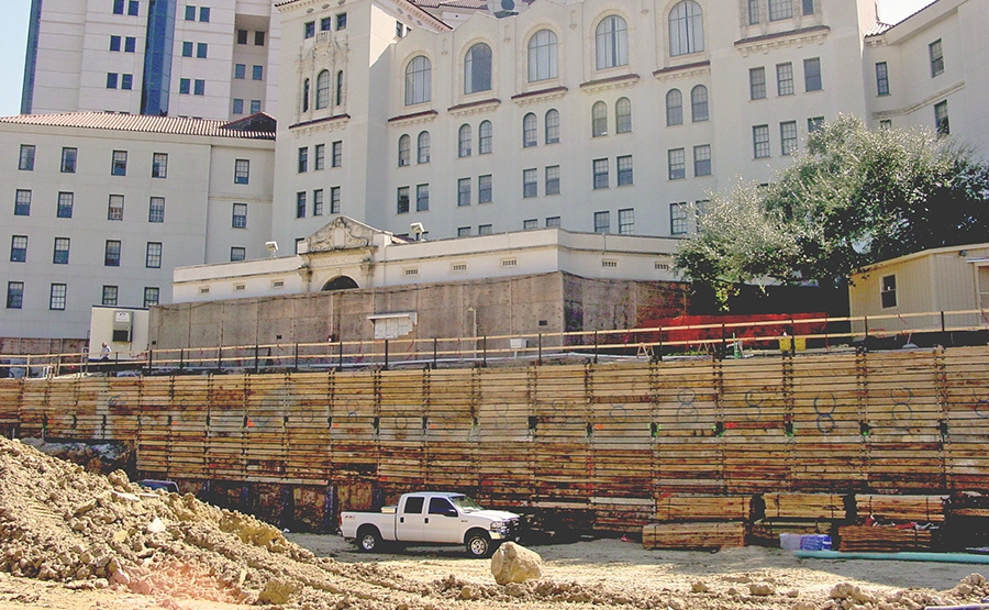
As part of an expansion to the Memorial Hermann Heart and Vascular Institute's (MHHVI) facilities on the Texas Medical Center campus in Houston, Texas, Hayward Baker, Inc. was selected to construct a new below ground parking structure immediately adjacent to an existing structure. The new facility required the excavation of approximately 42,000 sq. ft. to a depth ranging from 18 to 30 ft. below ground surface. Our client, Hayward Baker, was hired by the owner under a design-build approach to provide a temporary excavation support system for this project. Geosyntec was selected by Hayward Baker to prepare and certify the support system design. Our client's goals were to (i) design a system that did not require alteration of the parking facility design or construction methodology and (ii) install the excavation support system without disrupting hospital operations or adjacent utility systems.

Spring Water Production Services for Nestlé Waters North America

2026-04-02T15:49:49-06:00October 26th, 2009|

Nestlé Waters North America (NWNA) is the largest bottler of spring water in the United States and distributor of 15 of the country's best-known bottled water brands. Geosyntec provides engineering services at the spring sources and bottling facilities of Zephyrhills Brand and Deer Park Brand Natural Spring Water.

Seismic Evaluation and Rehabilitation of the Lake Petit Dam

2026-04-06T11:38:44-06:00October 26th, 2009|Tags: , , |

One of the highest dams in Georgia is a compacted earth structure that serves as a water supply source and supports recreational activities for the Big Canoe residential community in North Georgia. During a routine dam safety inspection by the Georgia Safe Dams Program (GSDP), potentially excessive seepage was reported near the toe of the dam. A resulting detailed evaluation of the existing site conditions led to the development (by others) of a rehabilitation program involving the construction of a large toe buttress to minimize the adverse impacts of the seepage and to provide the requisite calculated factor of safety regarding static and seismic slope stability. The goal of the dam owners (Big Canoe Property Owners Association) was to evaluate alternatives to the toe buttress remedy that could achieve the required factor of safety and be more cost-effective and less environmentally intrusive. Geosyntec was retained by the dam owners to perform an independent third party review of the recommended remedy and assist in the identification of alternatives.

Optimizing the Design Process for Dredged Material Containment Area Dike Raisings Adjacent to Savannah River Harbor

2026-06-16T14:30:21-06:00October 26th, 2009|Tags: , |

The Savannah River Harbor requires periodic dredging to support commercial shipping traffic. These materials are disposed within a series of diked, dredged material containment areas (DMCAs) located on the eastern side of the Savannah River in Jasper County, South Carolina. Under mutual agreement, the US Army Corps of Engineers dredges the materials from the Port and disposes the materials in specific DCMAs identified by the Chatham County (Georgia) Engineers Office. Under this agreement, the Georgia Department of Transportation (GDOT) is responsible for the design and maintenance of the DCMAs which occupy 5,635 acres of land and are bounded by nearly 44 miles of front, back, and divider dikes. Part of this responsibility is to design and stage the requisite dike raisings to provide sufficient dredged materials storage capacity along an 18-mile long reach of the river. At the time of the project, the previous two dike raisings initiated a series of relatively small and localized slope stability failures. Relatively expensive short-term stability measures had to be developed by GDOT to provide the requisite storage capacity. GDOT's primary objective for the project was development of a strategy for optimizing dike construction and DMCA management so that cost-effective long-term dredge material containment could be provided.

Geotechnical Design and Stormwater Management Consulting – Closed Landfill Conversion to Destination Park

2026-04-02T15:50:26-06:00October 24th, 2009|Tags: |

The closed Fresh Kills Landfill site on Staten Island is the largest remaining open space within New York City's five boroughs. The 2,200-acre site, active for more than 50 years, includes four waste disposal mounds ranging in height from 90 to 200 feet and is the final resting place of World Trade Center debris. The City has elected to retain ownership of the site and develop it as a world-class urban recreation destination, creating the Fresh Kills Lifescape Parkland.

Evaluation of Remote Sensing and Modeling as Tools for Planning Coastal Marsh Restoration Projects

2026-04-02T15:48:43-06:00October 24th, 2009|Tags: |

Although coastal salt marshes are now protected, man-made structures such as roads, bridges, undersized culverts, and earthen dikes remain as barriers that reduce tidal exchange and degrade habitat. Structures that reduce saltwater flows lead to long-term salt marsh habitat degradation through promotion of brackish invasive plants, poor water quality, and creation of physical barriers that limit access to nursery, refuge, and forage resources for fish.

Site Characterization and Removal Response Action at a Coal Tar Site on the Hudson River, Edgewater, New Jersey

2026-04-02T15:49:48-06:00October 24th, 2009|Tags: |

The Quanta Resources Site is located in a former industrialized parcel directly across the Hudson River from Manhattan. The site was used for coal tar storage from the 1930s until 1974, followed by the reprocessing of waste oil. The site previously contained over 60 aboveground storage tanks and 10 underground storage tanks having a total storage capacity of more than nine million gallons. During the years of plant operations, coal tar was off-loaded from barges docked at the site. The upland areas as well as the river sediment adjacent to the site contain a variety of contaminants including polycyclic aromatic hydrocarbons (PAH), arsenic, chromium, and lead. A plume of coal tar creosote exists beneath the site that extends into the Hudson River creating an oil sheen on the river adjacent to the site.The site was added to the National Priorities (Superfund) List in September 2002. Honeywell International retained Geosyntec to perform site investigation, a feasibility study, and remedial design services to control the oil sheen and to meet the overall requirements of U.S. EPA Region 2.

Go to Top