Geosyntec Consultants Logo

Geotechnical

Temperature Monitoring Multiple Landfills

2026-03-10T09:21:53-06:00December 27th, 2019|

Elevated temperatures have been measured in some municipal solid waste landfills. These temperatures, at times greater than 300°F, are not caused by fire but can cause significant difficulties with gas and leachate management systems. And because ETLFs are of environmental concern to landfill owners, designers, and regulators, Geosyntec was asked to design and install instrumentation to measure temperatures in a dozen elevated temperature landfills (ETLFs) across the U.S. The objectives of the assignment are to better understand the magnitude of the temperatures and the spatial distribution of the thermal conditions inside these landfills, and to provide data that can be used for thermal modeling to diagnose what is causing the rise in temperatures and monitor the effectiveness of remedial actions to contain and possibly cool the exothermic reaction.  

Twin Circuit 230-kV Underground Transmission Line Sunrise Powerlink Project

2026-04-07T09:46:38-06:00October 20th, 2019|Tags: |

As part of a new 120-mile long transmission line, San Diego Gas & Electric Company (SDG&E) constructed an approximately six-mile, twin circuit 230-kV transmission line, placed underground in the Alpine area of San Diego County, California.

Geotechnical and Water Quality Instrumentation Installation and Monitoring

2026-04-02T16:21:39-06:00May 29th, 2019|

Geosyntec installed solar powered water quality monitoring units at the Center Hill Dam to wirelessly transmit construction and other  data to a real-time internet-based reporting system. Geosyntec installed solar powered water quality monitoring units at the Center Hill Dam to wirelessly transmit construction and other  data to a real-time internet-based reporting system. The US Army Corp of Engineers (USACE) managed a $106 million rehabilitation of the Center Hill Dam in Tennessee. The massive rehabilitation effort included the installation of an approximately 200,000-square-foot barrier wall, the main protective feature in the seepage remediation project that extends more than 300 feet into the earthen embankment and underlying foundation bedrock. Center Hill Dam is the highest priority project of USACE's system for the development of the water resources of the Cumberland River Basin. As a major unit in the system, Center Hill Dam and Lake function to control the floodwaters of the Caney Fork River and contribute to the reduction of flood levels at municipal, industrial, and agricultural areas along the Cumberland and lower Ohio and Mississippi Rivers. In addition to the far-reaching effects of flood control, the dam contributes to the electrical power supply of the area through the generation of hydroelectric power. Monitoring of instrumentation during construction is a key method by which the USACE ensures not only the safety of the dam itself but the safety of the workers at the dam as well.

Fossil River Reach Thermal Model Updates

2026-04-02T16:21:37-06:00April 15th, 2019|

The Tennessee Valley Authority (TVA) manages a large system which includes fossil and nuclear plants, dams and reservoirs. TVA uses a series of numerical models to evaluate water temperature and water quality in its river-reservoir reaches to help meet regulatory criteria and identify potential regulatory issues and solutions. The modeling tools used by the TVA include CE-QUAL-W2, ADYN-RQUAL, and an internally developed model (BETTER). As part of a larger evaluation of its system-wide modeling tools, Geosyntec assisted TVA in updating their numerical models used for the fossil plant river-reservoir reaches to ensure the most appropriate tools and latest versions are being used. In addition, Geosyntec improved the accuracy of some of the models, to improve their ability to predict water temperature changes. This assists TVA hydrothermal personnel with maintaining regulatory compliance while maximizing the energy system production.

Geotechnical Engineering and Construction Services at Red Dog Mine

2026-04-07T08:41:47-06:00January 16th, 2019|

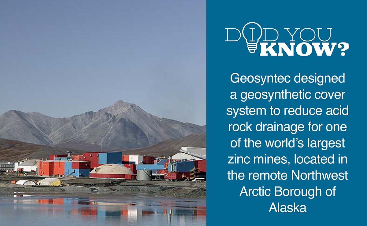
Red Dog Mine is one of the world's largest zinc mines, located in the remote Northwest Arctic Borough of Alaska and operated by Teck Alaska, Inc. (TAK). Mine operations required the stockpiling of waste rock excavated from the first surface mine pit. The natural composition of the waste rock creates acid rock drainage (ARD) that is collected and treated by the mine before being discharged. TAK contracted Geosyntec to prepare a design of a cover system to minimize ARD. Because the mine is in a remote, artic region, the construction season and material delivery timeframe are typically limited to the summer, making design, construction, and oversight services particularly challenging.

Geotechnical Monitoring for the Replacement of the Chickamauga Lock

2026-04-06T13:29:14-06:00November 26th, 2018|

The Chickamauga Lock is a navigation lock on the Tennessee River, seven miles upstream of Chattanooga. Because the existing 80-year-old 60-foot-by-360-foot lock was no longer suitable for the larger barges now used by the transportation industry, the decision was made to replace the lock with a new 110-foot-by-600-foot lock. The new lock makes barge transport more efficient and solves structural issues caused by the existing concrete aggregate. As part of this project, Geosyntec provided geotechnical monitoring during the replacement, maintaining and operating an automated instrumentation and data-management system. This system was used to enhance worker safety while the lock was being installed to monitor the existing lock during construction and to verify structural performance consistent with design expectations.

Slope Stability Evaluation for Film Production Location

2026-04-14T09:31:27-06:00April 13th, 2018|

Geosyntec Consultants provided a time-critical geotechnical analysis to support Theoretical Pictures Film Company at a special effects location shoot for the Academy Award-winning film Dunkirk. Acclaimed director Christopher Nolan had chosen the Point Vicente sea cliff in California as a desired filming location. The film shoot production required the use of a 30,000-pound base with a gimballed aircraft fuselage set piece to be used near the 100-foot sea cliff edge. In addition, a 100-ton crane using outriggers was needed to move the set pieces.

Boone Dam 3-D Geospatial Model

2026-04-14T09:32:20-06:00December 1st, 2017|

Geosyntec developed and implemented an information management system (IMS) and an Instrumentation Data Acquisition System (IDAS), collectively known as the BooneDamIMS. The system brings together ongoing reconstruction data, real-time instrumentation monitoring, and historic data in a manner that allows these data to be rapidly organized, analyzed, visualized, and made accessible to contractors.

Site C Dam Compilation and Visualization Grouting and D-Wall Panel Data

2026-03-08T09:15:29-06:00December 1st, 2017|

Geosyntec developed tools to compiled and visualize grouting and D-Wall panel data from the left bank grout curtain and slurry wall construction. In addition to immediately visualizing the data in interactive tools, Geosyntec designed and populated a database that can be used in future dam safety analyses.

Go to Top