Geosyntec Consultants Logo

Massachusetts

Ballard Street Salt Marsh Restoration

2026-04-02T15:51:22-06:00October 29th, 2009|

The Ballard Street salt marsh is located just northeast of Boston in a densely populated urban area. In the 1960s, the construction and subsequent abandonment of a 30-foot high interstate highway berm began the process of the degradation of the marsh by cutting off tidal flow and trapping sediments, elevating water levels above sea level, and creating a brackish environment. The existing degraded habitat is further threatened by tidal restriction from outdated, non-functional tide gates.

Long Pond Watershed Low Impact Development Program for Water Quality Improvements

2026-04-02T15:51:22-06:00October 29th, 2009|

The Town of Littleton's Clean Lakes Committee obtained a Clean Water Act Section 319 grant from the Massachusetts Department of Conservation and Recreation (DCR) to implement a series of low impact development (LID) projects and other improvements to the area in and around the Long Pond beach to better treat stormwater, eliminate or minimize beach closings, and generally improve the pond's water quality. The 99-acre pond is listed by the State as "impaired" by nutrients, low dissolved oxygen, and noxious aquatic plants. Excessive nutrient loading comes from the adjacent residential septic tank systems and runoff from the curb-and-gutter stormwater collection system within this rapidly urbanizing community northwest of Boston. Littleton's long-term goal for Long Pond is water quality improvement that will return the beach area to an attractive recreation destination for town residents.

Massachusetts DEP Nonpoint Source Pollution Guidance Manual and Technology Assessment Resource Tool

2026-04-02T15:51:22-06:00October 29th, 2009|

In 1993, the Massachusetts Department of Environmental Protection (MassDEP) published the Nonpoint Source Pollution Management Manual, commonly referred to as the "MegaManual" due to its hard-copy format that filled a four-inch binder. The MegaManual was intended to provide guidance to municipal officials on how best to manage nonpoint source (NPS) pollution to surface waters. However, due to the document's format, volume, limited distribution, and organizational structure, MassDEP observed that this document was not reaching a broad audience, being used effectively, or reflecting the latest information on technologies and management strategies. MassDEP wanted to reinvent the way it communicated standards, practices, and technologies to stormwater management.

Low Impact Development Stormwater Designed to Improve Water Quality in Shellfish Habitat in Plymouth Harbor

2026-04-02T15:50:27-06:00October 29th, 2009|

Shellfishing is a major recreational and commercial industry in southeastern Massachusetts. Among the many threats to its continued viability is contaminated stormwater runoff. In the Plymouth Harbor watershed, traditional stormwater collection and discharge systems were directing contaminated runoff directly onto the shellfish beds from both point and nonpoint sources (e.g., parking lots, roofs, playing fields, etc.). As a result, fecal coliform bacteria, total suspended solids, petroleum hydrocarbons (oil and grease), and metals posed significant threat to the Plymouth Harbor shellfish communities.The Town of Plymouth proposed to address the issue of contaminated stormwater runoff by source controls at selected locations throughout the watershed. The Town indicated a strong preference for the use of low impact development (LID) approaches that incorporate on-site infiltration and passive treatment methods. The Town's goal was to selected a consultant who could apply LID approaches in ways that would improve water quality in Plymouth Harbor to the point that native shellfish habitats were no longer threatened.

Silver Lake LID Demonstration Project

2026-04-06T13:24:08-06:00October 29th, 2009|

Silver Lake, in the northern suburbs of Boston, is heavily used for recreational purposes such as swimming, fishing, wildlife viewing, and boating. However, the lake is degraded from nutrients, sediment, and bacteria from the surrounding conventional stormwater systems (which include several direct discharge outlets to the lake) and nonpoint source runoff. Beach closures due to high bacteria counts had become a repeated occurrence. The Ipswich River basin in which Silver Lake sits is a heavily stressed watershed. American Rivers named the Ipswich River the third most endangered river in the country in 2003, reflecting the severe and chronic reductions in flow the river has experienced, mainly due to evapotranspiration rates from development and increased groundwater withdrawals. Long sections of the river had even occasionally dried up altogether.The Massachusetts Department of Conservation and Recreation (DCR) received a demonstration grant from the U.S. EPA's Targeted Watershed Program to demonstrate an integrated approach to addressing the multiple problems facing the Ipswich River. Their goal was to employ innovative techniques to help increase groundwater recharge and base flow. The Town of Wilmington, working with the DCR, wanted to look into ways to minimize polluted stormwater runoff entering Silver Lake, improve the lake's water quality, and minimize the number of beach closings each summer due to bacteria violations. Low impact development (LID) strategies, such as landscaping and design techniques that capture stormwater and recharge it to the groundwater before it enters a surface water body, if employed widely, could potentially assist in meeting these multiple goals.

Town Line Brook Stormwater Management Planning and Design

2026-04-06T11:39:56-06:00October 29th, 2009|

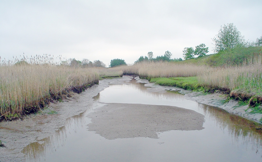
The highly urbanized Town Line Brook watershed contains parts of four coastal towns that were long ago developed on a former salt marsh and that continually flood during storm events. Causes of flooding in the area were believed to include tidal and stream flow restrictions and lack of adequate drainage due to the highly urbanized conditions. Impacts of flooding include water quality problems, sedimentation, damage to homes and businesses, sewer backup conditions, and increased runoff.The Massachusetts Environmental Trust (MET) provided grant funding to study the exact causes of the flooding in the Town Line Brook area, and to propose a variety of management and engineering options to correct the problem. Before this project, many study dollars had been spent to produce hard engineering solutions involving very expensive infrastructure improvements. MET was hoping to find an effective solution that would not drain the public coffers.

Nuclear Metals, Inc. Superfund Site Remedial Investigation and Feasibility Study

2026-06-16T14:30:08-06:00October 29th, 2009|Tags: , , |

Nuclear Metals, Inc. (NMI) used depleted uranium (DU) in the manufacture of penetrators for the US Army. From 1958 to 1985, process waste (DU, nitric acid, and lime) was disposed in an unlined holding basin at this Boston-area manufacturing facility now surrounded by residential neighborhoods. As a result, DU was released to soils and groundwater near the basin.

Shawsheen River Interactive Recreational Map

2026-06-16T14:30:06-06:00October 29th, 2009|

The Shawsheen River winds for about 25 miles through all or parts of 12 communities in northeastern Massachusetts before emptying into the Merrimack River in Lawrence. With the decline of its industrial base, and especially since passage of the Clean Water Act in the 1970s, local citizens have begun looking at the Shawsheen River as a resource for outdoor recreational opportunities such as canoeing, hiking, biking, fishing and sightseeing. However, it was difficult to find out where such opportunities existed and how to take advantage of them. The Massachusetts Division of Fish, Wildlife and Environmental Law Enforcement (Fish & Wildlife) established a goal of providing an easily-accessible and complete graphic representation of the various recreational opportunities along the Shawsheen River from its source to its mouth. Originally envisioned to be simply a hard copy map, an interactive web-based version was also needed to encourage maximum distribution and usage. Both versions would need to be easy to use.

Preliminary TMDL and Nonpoint Source Pollution Assessment of Coastal Areas in Southern Massachusetts

2026-06-16T14:30:14-06:00October 27th, 2009|

Section 303(d) of the Clean Water Act requires states to list water bodies as "impaired" if they do not meet one or more of a defined list of water quality standards. It also requires the states to determine Total Maximum Daily Loads (TMDLs) for the pollutant(s) in each impaired water body that are contributing to the impairment. TMDLs determine the amount of a pollutant that a water body can safely handle without violating water quality standards.In 2001, the Massachusetts Department of Environmental Protection (MassDEP) classified 32 ponds and stream segments as "impaired" under Section 303(d) in the towns of Plymouth, Kingston, and Pembroke in southeastern Massachusetts. These towns fall within the state's South Coastal watershed. Many of these water bodies were impaired due to noxious aquatic plants, but other pollutants included metals, turbidity, bacteria, and nutrients.The regional watershed coordinator with the MassDEP for the South Coastal watershed identified the need to conduct a further investigation of the 32 listed water bodies to assess the nature of the pollution problems and to identify which water bodies were in most need of attention.

Implementation of an In Situ Thermal Desorption Remedy for Regulatory Site Closure

2026-04-02T15:50:27-06:00October 27th, 2009|Tags: |

A portion of the privately owned "Route 44" property was excavated in the 1930s for fill for an off-site construction project. The resulting borrow pit was gradually filled with drums containing a variety of wastes. In the 1990s, the U.S. EPA conducted a series of site characterization studies, and in 2001, removed over 800 drums from the site. These removal activities were suspended after labels bearing the name of a nearby manufacturer were found on some of the drums. EPA then sent a Remedial Action letter to the corporate successor of that firm, who subsequently retained Geosyntec to provide oversight of the remaining drum removal activities, as well as to guide the site through the subsequent site assessment and remediation process and to ultimately achieve regulatory closure under the Massachusetts Contingency Plan (MCP).

Go to Top