Geosyntec Consultants Logo

Robert Roseen

Hydropower Licensing and Compliance

2026-09-23T13:26:26-06:00April 15th, 2026|Tags: , , , , , , , , , , , , , , , , , , , , , , , , , , , , , , , , , , , , , |

To help clients achieve stringent water quality goals, Geosyntec provides rigorous assessment and modeling services to assess the sources and factors that affect the delivery of critical pollutants across watersheds. Through our comprehensive studies and analyses, we provide technically defensible tools and approaches that can be used in the development of Total Maximum Daily Load (TMDL) calculations and watershed protection plans. In addition, we frequently turn to Use Attainability Analyses to examine site-specific water quality criteria that affect attainability goals under natural, human-caused, and economic conditions. Our hydrodynamic and water-quality models integrate inputs from point and nonpoint sources to support our engineers and scientists as they study impacts on water quality in receiving water. These models allow us to understand the assimilative capacities of a given body of water, propose best management practices that can affect pollutant impacts, and predict the time required for a system to recover after being altered. Using watershed studies, water quality monitoring, and hydrological and hydrodynamic modeling, we also can assess compliance with local, state, and federal water quality standards. Using all this information, we are better able to evaluate the magnitude, frequency, and duration of impacts of a wide variety of pollutant sources. Our practitioners offer extensive experience with geographic information system applications for spatial analysis, planimetric and thematic mapping, and data representation. We employ watershed models including the Watershed Characterization System (WCS), Better Assessment Science Integrating Point and Nonpoint Sources (BASINS), and the Watershed Assessment Model (WAMView). We also employ the Water Quality Analysis Simulation Program (WASP), the Environmental Fluid Dynamics Code (EFDC), and the Stream Water Quality Model (QUAL2K) for hydrodynamic and water-quality models. Our practitioners are at the forefront of policy analyses, regulatory compliance, and technology applications that promote sustainable water resources management and ecosystem restoration. We have extensive experience helping local governments develop and negotiate long-term control plans for combined sewer overflows, National Pollutant Discharge Elimination System (NPDES) permits, and consent orders. We also comment on Clean Water Act issues at the state and national level, including the development of new recreational use criteria for water bodies across the county and for the U.S. Environmental Protection Agency's new framework for integrated planning for wastewater and stormwater.

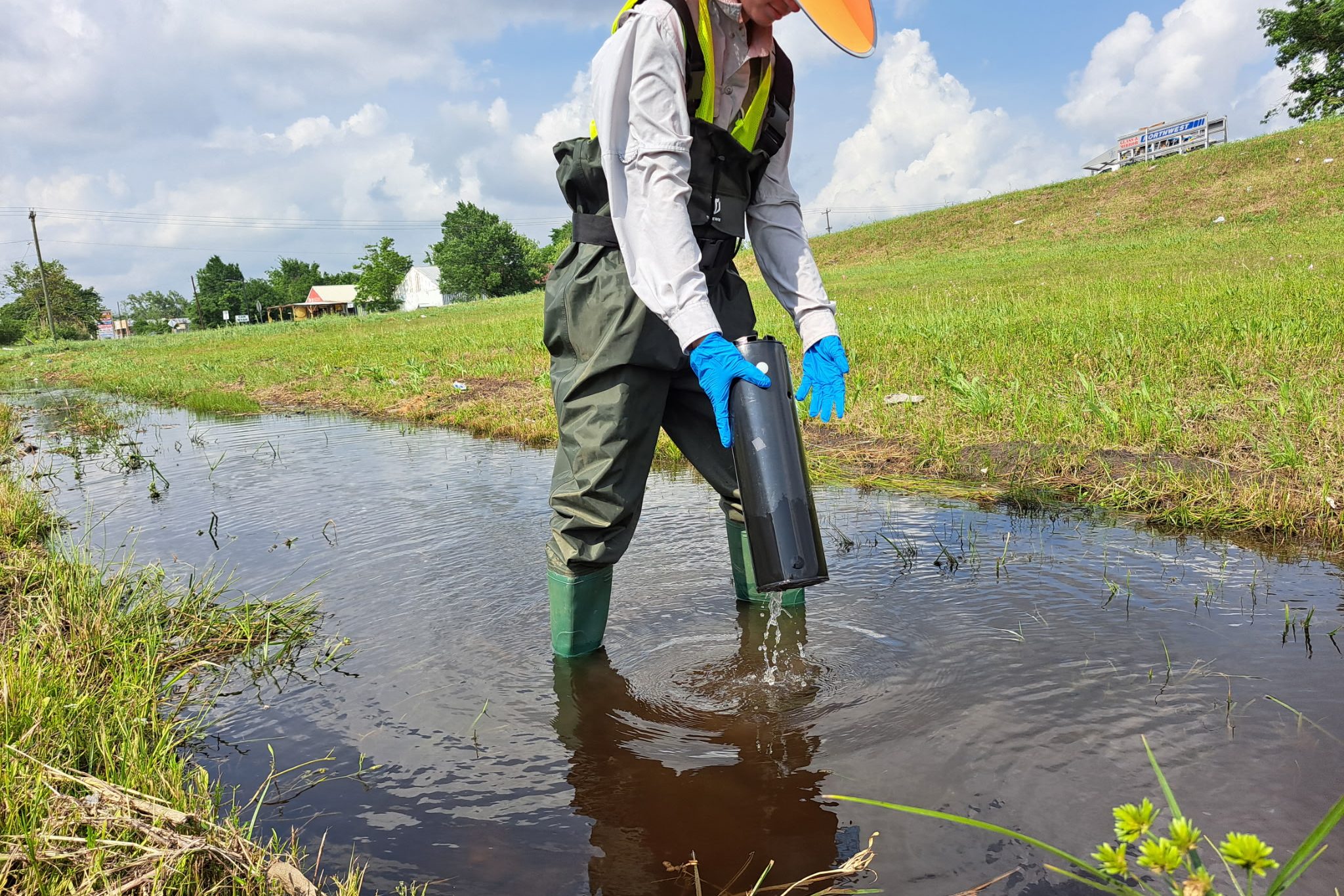
Erosion and Sediment Control

2026-03-15T10:46:50-06:00February 12th, 2015|Tags: , , , , , , , , , , , , , , , , , , , , , |

Soil erosion and resulting sedimentation can cause widespread damage to waterways and impact drinking-water quality, endanger wildlife resources, and hinder the flood-control capacity of lakes and reservoirs. For the most challenging projects and construction programs, Geosyntec has extensive experience developing effective stormwater pollution prevention plans (SWPPPs), erosion and sediment (E&S) control and revegetation plans, hydrologic and hydraulic models, and designs for stormwater best management practices (BMPs).

Watershed Planning and Stormwater Management

2026-05-27T11:38:15-06:00February 12th, 2015|Tags: , , , , , , , , , , , , , , , , , , , , , , , , , , , , , , , , , , |

State and local governments, utilities, landowners, businesses, and communities must navigate National Pollutant Detection and Elimination System (NPDES) Permit compliance through watershed-scale planning.

Low Impact Development, Green Infrastructure, Sustainable Practices

2026-04-23T13:00:13-06:00March 28th, 2014|Tags: , , , , , , , , , , , , , , , , , , , , , , , , , , , , |

Low impact development (LID) aims to mimic natural hydrology by using small-scale, decentralized techniques that infiltrate, evaporate, and transpire rainwater. The guiding principles of LID are to reduce imperviousness, disconnect imperviousness, conserve natural resources and areas, maintain natural drainage courses, and minimize clearing and grading. Geosyntec practitioners have designed and integrated a number of innovative system architectures to help clients meet each of these goals. Through the use of the latest green infrastructure (GI) and by implementing new sustainable practices, many of our clients have addressed challenges that previously were intractable, unachievable, or not cost effective using conventional passive solutions. We provide specialized stormwater and watershed management services for private facilities, large developers, stormwater utilities, and municipal agencies throughout the United States and have implemented many of the nation's first GI projects. Our stormwater management specialists form one of the leading practices in the country and include individuals whose applied research earned the American Society of Civil Engineers Civil Engineering State-of-the-Art Award and similar accolades at the state and regional level. Our firm's efforts in LID are geared to lower costs for stormwater infrastructure and maintenance, improve surface water quality and groundwater recharge, and design an attractive, ecologically functional landscape. We also have incorporated LID approaches into new development and retrofit projects to improve control of both quantity and quality of stormwater. Geosyntec personnel continuously shape the state of the practice with projects that involve original research, development, and application of LID techniques. Our engineers and scientists are represented on the Board of Directors of the Low Impact Development Center, a nonprofit organization dedicated to the advancing LID technology, and maintain joint research projects with civil engineering faculty at leading academic institutions.

Discharge Permitting and Receiving Water Studies

2026-04-23T14:52:37-06:00March 28th, 2014|Tags: , , , , , , , , , , , , , , , , , , , , , , , , , , , , , , , |

Geosyntec provides comprehensive water-quality permitting and receiving water-assessment services. Our services include the National Pollutant Discharge Elimination System (NPDES) permitting negotiations and technical support for wastewater and industrial wastewater treatment plant discharges, groundwater discharge, combined sewer overflow systems, and stormwater management. Our water-resources practitioners also specialize in water-quality assessments in large watersheds, rivers, and reservoirs. Many of these projects are multi-year efforts where our services have eliminated unnecessary treatment works, saving clients significant costs. Antidegradation and Water-Quality Reviews Antidegradation and water-quality reviews are essential for permitting wastewater discharge expansions. Regulators use these reviews to determine treatment-system requirements and effluent limitations. Permittees must prepare the review submittals for new or expanded treatment plants. These reviews can range in complexity from basic qualitative evaluations to complex modeling scenarios using actual stream data. Using our thorough understanding of antidegradation and water-quality review processes,we help clients select the most appropriate review approaches when pursuing new or expanded wastewater treatment plants.  Regulators with the US Environmental Protection Agency (USEPA) and state regulators emphasize water-quality-based permitting of municipal, domestic, and industrial wastewater discharges.They do this to address water-quality concerns and attain water-quality standards within receiving streams, rather than basing permits on technology-based limitations that may not adequately protect the specific water resource. Waste-Load Allocation Geosyntec's water-quality-based permitting and waste-load allocation studies may range greatly in complexity, and regulatory involvement and negotiations are critical elements within such projects. Waste-load allocations may be derived using a variety of approaches, and water-quality-based permit limits are derived after determining the most appropriate and defensible waste-load allocation.  Our engineers and scientists use state-of-the-art field monitoring approaches to calibrate water-quality models and establish appropriate water-quality criteria. We have saved our clients several millions of dollars in infrastructure investments by investigating conservative permit assumptions and ensuring a sustainable balance between resource needs and practical budget constraints.

Natural Resource Monitoring

2026-04-23T13:04:19-06:00March 28th, 2014|Tags: , , , , , , , , , , , , , , , , , , , , , , , , , , , , |

Geosyntec uses biological assessment and monitoring to create an accurate picture of the affected environment. Our services reliably evaluate the health of streams, rivers, lakes, and ocean environments. In addition, we can offer a less expensive alternative to complex chemical testing programs. Relying on deep experience, our team evaluates the ecological health of a given environment to show how organisms integrate the effects of varied stressors at your site over time. This means Geosyntec can characterize long-term ecological issues and understand the status of highly valued biological communities. By examining a variety of species, their life stages, their survival, and their health, Geosyntec deciphers complex relationships among habitats, bioregions, and ultimately, water and sediment quality. Geosyntec has experienced biologists who efficiently conduct fish and invertebrate collection for both site investigations and NPDES-permit compliance. We also partner with industry-leading laboratories to analyze samples, compile metric scores and data into a project database, and use geographic information system capabilities to define spatial relationships and ensure data consistency and comparability. Geosyntec's biological monitoring services include fish tissue collection for analysis of chemicals of concern; fish population and macroinvertebrate/plankton community studies; fish-kill investigations; and sediment infaunal invertebrate studies. We also conduct habitat inventories and assessments; sediment and water quality toxicity testing; ecological risk assessments; and Natural Resource Damage Assessments. Our practitioners compile environmental impact statements for compliance with National Environmental Policy Act requirements and consult with clients on Clean Water Act (CWA) Section 404 wetland permitting, Section 401 water quality certification, and threatened and endangered species surveys related to the Endangered Species Act (ESA) and Section 7 requirements. For more than a dozen clients, Geosyntec has monitored the concentrations of chemicals found in fish tissue over many years. Often, the fish community is exposed to chemicals via direct or indirect uptake from contaminated sediments. By monitoring the fish tissue concentrations over time, the effectiveness of an environmental remedy can be evaluated. Additionally, biota-sediment accumulation models can be developed and refined to support informed management decisions. This has been used for both active remedies (like dredging) and passive remedies (like MNR). These monitoring data provide our clients and the regulatory agencies with an accurate picture of the affected environment.

Watershed & Water Quality Studies and Modeling

2026-04-29T11:27:51-06:00March 27th, 2014|Tags: , , , , , , , , , , , , , , , , , , , , , , , , , , , , , , , , , , , , , |

To help clients achieve stringent water quality goals, Geosyntec provides rigorous assessment and modeling services to assess the sources and factors that affect the delivery of critical pollutants across watersheds. Through our comprehensive studies and analyses, we provide technically defensible tools and approaches that can be used in the development of Total Maximum Daily Load (TMDL) calculations and watershed protection plans. In addition, we frequently turn to Use Attainability Analyses to examine site-specific water quality criteria that affect attainability goals under natural, human-caused, and economic conditions. Our hydrodynamic and water-quality models integrate inputs from point and nonpoint sources to support our engineers and scientists as they study impacts on water quality in receiving water. These models allow us to understand the assimilative capacities of a given body of water, propose best management practices that can affect pollutant impacts, and predict the time required for a system to recover after being altered. Using watershed studies, water quality monitoring, and hydrological and hydrodynamic modeling, we also can assess compliance with local, state, and federal water quality standards. Using all this information, we are better able to evaluate the magnitude, frequency, and duration of impacts of a wide variety of pollutant sources. Our practitioners offer extensive experience with geographic information system applications for spatial analysis, planimetric and thematic mapping, and data representation. We employ watershed models including the Watershed Characterization System (WCS), Better Assessment Science Integrating Point and Nonpoint Sources (BASINS), and the Watershed Assessment Model (WAMView). We also employ the Water Quality Analysis Simulation Program (WASP), the Environmental Fluid Dynamics Code (EFDC), and the Stream Water Quality Model (QUAL2K) for hydrodynamic and water-quality models. Our practitioners are at the forefront of policy analyses, regulatory compliance, and technology applications that promote sustainable water resources management and ecosystem restoration. We have extensive experience helping local governments develop and negotiate long-term control plans for combined sewer overflows, National Pollutant Discharge Elimination System (NPDES) permits, and consent orders. We also comment on Clean Water Act issues at the state and national level, including the development of new recreational use criteria for water bodies across the county and for the U.S. Environmental Protection Agency's new framework for integrated planning for wastewater and stormwater.

Urban Stormwater Management, Planning, & Design

2026-05-04T12:16:00-06:00March 27th, 2014|Tags: , , , , , , , , , , , , , , , , , , , , , , , , , , , , , , , , , , , , , , |

Geosyntec's engineers and scientists stand among the world's foremost experts in urban stormwater management. We are innovators who design best management practices to mitigate impacts to surface water quality, enhance water conservation strategies, and contribute to municipal water supplies. Our professionals develop and implement comprehensive water quality master plans and site-specific designs using green infrastructure concepts for long-term stormwater control. We also guide the development and design of construction, industrial, and municipal programs for National Pollutant Discharge Elimination System (NPDES) regulatory program compliance. We have evaluated the opportunities, constraints, effectiveness, and costs associated with a variety of low impact development and green-streets options and have provided conventional treatment control BMPs for maintaining water quality control. We provide end-to-end solutions for a wide variety of applications from proprietary cistern sizing and optimization modeling and water collection and pre-filtration strategies, to designs for filtration, treatment, and water distribution systems. Our water resources engineers specialize in surface-water and groundwater interactions, ecosystem restoration, multi-beneficial project development, hydromodification management, and erosion and sediment control. In addition, our practitioners have been instrumental in developing, publishing, and supporting numerous stormwater guidance and design manuals. Geosyntec professionals established and continue to contribute to the International Database on Urban Stormwater BMP Design and Performance. We frequently present state-of-the-practice training sessions and workshops on stormwater management, NPDES regulatory program requirements, erosion and sediment control technologies, and BMP performance and design.

Modeling and Management of Stream Hydromodification Impacts

2026-03-15T10:45:46-06:00March 27th, 2014|Tags: , , , , , , , , , , , , , , , , , , , , , , , , , |

Geosyntec offers extensive experience in hydrologic and hydraulic modeling and the use of model output for the analysis of channel modifications and stream restoration projects. We frequently apply these models for long-term watershed and floodplain management. Our practitioners have decades of experience in the evaluation of hydromodification activities, such as channelization / channel modification projects and the construction of dams. We also examine the resulting stream bank and shoreline erosion impacts of hydromodification and how it might affect in-stream and streamside (or riparian) habitats for fish and wildlife. We develop and calibrate watershed hydrologic models and floodplain hydraulic models using new and existing data sources to examine both the volume reduction and control benefits of hydromodification projects. We also conduct stream restoration and open channel analyses to assist and design stream bank rehabilitation projects and to restore tidal flow in restricted salt marsh environments. Our geomorphic studies and sedimentation/scour analyses are used to understand issues of accelerated erosion or changes to sediment supply. We apply our expertise in open channel hydraulics to perform flooding analyses, including floodplain delineation, flow monitoring, and rating curve development. Geosyntec has developed excellent surface water modeling expertise including hydrodynamics, sediment transport, water quality, and fate and transport modeling. Geosyntec's expertise includes application of SWMM, HEC-HMS, HEC-1, HEC-2, HEC-RAS, RMA2/RMA4, EFDC, QUAL2k, River-FLO2D, CE-QUAL-W2, Computational Fluid Dynamics, and other models.

Wetland Delineation and Permitting

2026-03-15T10:45:46-06:00March 27th, 2014|Tags: , , , , , , , , , , , , , , , , , , , , , , , , |

Geosyntec practitioners are leaders in the development and application of science-based methods and tools for wetland identification and delineation. By determining the existence, location boundaries, and physical size of a wetland area, we help clients establish whether water bodies within a project area meet criteria for regulation under specific local, state, and federal jurisdictions. In addition, we make recommendations as to the size or width of any buffers that may be needed to protect water quality or habitats. Our field investigations and surveys establish clearly marked wetland boundaries, comprehensive delineation maps with data collection points, and site-specific information such as soil survey results or species composition and dominance data. We also can assess whether created or replicated wetlands function effectively and then aid clients in the application of this information to future design plans. This can include an evaluation of pre-construction design criteria and monitoring protocols. Once a wetland delineation is complete, Geosyntec guides clients through the permitting application process as outlined in Section 401 or Section 404 of the Clean Water Act as well as the various state and regional laws governing water bodies throughout the United States.

Go to Top