
Impervious Surface Assessment Using High Resolution Satellite Imagery
Client
County of Santa Barbara
Services Provided
Data Gap Analysis; Satellite Imagery Interpretation; Watershed Delineation; Training; Public Outreach
Location
Santa Barbara County, California, USA
Project Practice Areas
Water and Natural Resources
Type of Facility
Watershed
Project Specifics
The County of Santa Barbara in southern California needed to enhance its available data resources with which to manage its stormwater runoff water quality. The County felt that there were significant gaps in existing data that it needed to make long-range planning decisions.
In particular, there were significant data gaps in their GIS system, such as detailed estimates of impervious cover, recent high quality multi-spectral orthophotography, etc. These data were needed in order to facilitate the implementation of stormwater best management practices, or BMPs. Ultimately, with limited funds with which to implement BMPs, the County’s goal was to prioritize which areas needed attention first in terms of retrofits, new nonpoint source water quality control, etc.
Geosyntec Scope of Services
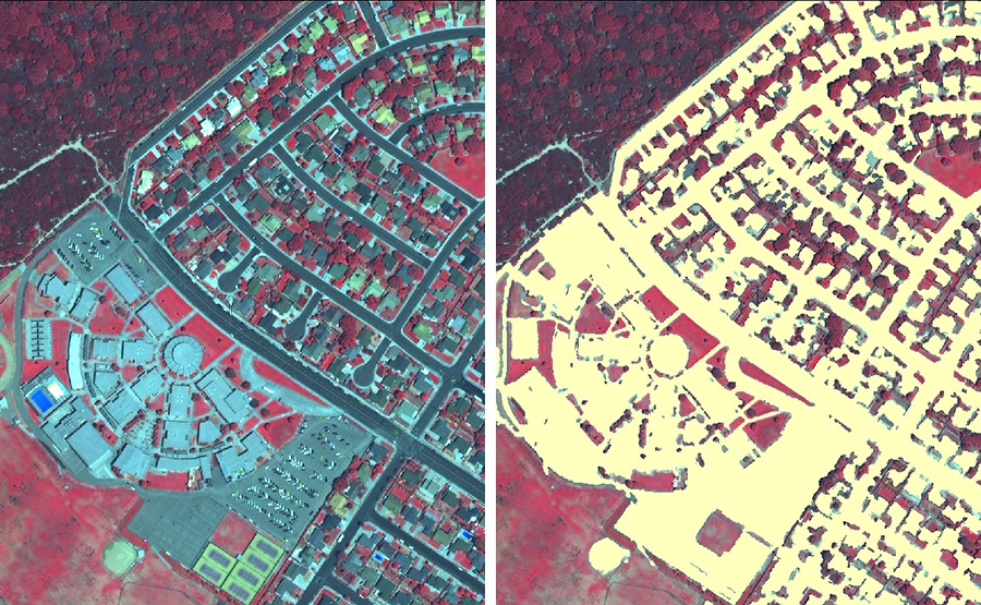
The County of Santa Barbara retained Geosyntec to use an innovative remote sensing approach to estimate the amount of impervious surfaces throughout the County. We began by evaluating the County’s existing data sets and performing a gap analysis. Through this gap analysis, we were able to identify and prioritize the County’s need for additional data collection and analysis.
Geosyntec then obtained new client-specific, high resolution, multi-spectral satellite imagery for all of the urbanized unincorporated areas of the County. We obtained this high resolution data from the Quickbird Satellite through Digital Globe. Using a new generation of software and hardware, Geosyntec was able to extract extremely detailed estimates of impervious surface data from these images. We analyzed the imperviousness data in conjunction with existing land use and parcel data, and developed the subwatershed delineations that the County needed. As a final step, we provided this data to the County in a format that was useable for a wide variety of future planning needs.
Notable Accomplishments
Geosyntec worked with the County of Santa Barbara to conduct one of the largest-scale high resolution estimates of impervious surfaces in the country. We dramatically improved the planning tools available to the County for implementation of stormwater BMPs, and have provided invaluable assistance in their being able to prioritize which parts of the County are in most need of attention. And by getting an article about this project published in a national trade magazine, we were able to get the County recognized as leaders in the use of technology in municipal planning.
Related Projects

Lee County Division of Natural Resources
Lee County, Florida

Water Environment Research Foundation (WERF), National Corn Growers Association (NCGA)
Internet Resource

City of Chicago Department of Housing and Economic Development
Chicago, Illinois, USA

Martin County Parks and Recreation Department
Martin County, Florida

4D Delivery Ltd on Behalf of Southern Water Portsmouth
England


