
Eielson Air Force Base PFAS Fate and Transport Simulation Model
Client
Ahtna & AFCEC
Services Provided
Well Inventory and Database Construction, Mobile Data Management, Permafrost Conceptual Model, Stable Isotope Sampling, Calibrated Groundwater Flow Model, PFAS Fate and Transport Simulation

Location
North Pole, Alaska
Project Practice Areas
Water and Natural Resources
Type of Facility
Permafrost Delineation
Project Specifics
The United States Air Force Civil Engineer Center (AFCEC) required the development of a base-wide groundwater hydrology model to evaluate transport of per- and polyfluoralkyl substances (PFAS) in relation to known groundwater-use receptors at the Eielson Air Force Base (AFB).
Geosyntec Scope of Services
Geosyntec provided technical support to Ahtna Engineering Services (Ahtna) and AFCEC in the construction and calibration of a numerical groundwater flow model using Modflow-USG to aid in the evaluation of known and suspected groundwater contamination from PFAS. Our services included the development of a base-wide conceptual model that incorporated the lithology, hydrogeology, and permafrost distribution in the area within and surrounding Eielson AFB. Lithology and permafrost data were compiled from a variety of sources such as the AFCEC Aministrative Record and Alaska Department of Natural Resources Well Log Tracking System, as well as documents obtained under the Freedom of Information Act. As part of the model calibration, information was gathered about local pumping wells and areal recharge to understand groundwater withdrawals and sinks. To gain a better understanding of discontinuous permafrost and the connection between supra- and sub- permafrost groundwater within the model domain, Geosyntec and Ahtha collected and evaluated groundwater stable isotope samples in collaboration with the University of Alaska Fairbanks.
Geosyntec developed a comprehensive database of well information, historical and recent groundwater and surface water level data, lithology, and permafrost data to serve in development of the model as well as future investigations. A mobile platform for recording well construction and condition information was developed and used to construct a comprehensive inventory of groundwater wells (abandoned and existing). The mobile app minimized documentation errors and improved data quality and integrity during sub-freezing field conditions. The inventory was used to select wells for decommissioning as part of the Eielson AFB installation monitoring program.
A numerical groundwater flow model was developed in MODFLOW-USG that encompassed over 90 square miles in and around Eilson AFB. The model was calibrated to simulate historical flow conditions and included a visual and statistical comparison of observed and modeled steady-state water level elevations, potentiometric contours and hydraulic gradients. Fate and transport simulations included 10- and 20-year projections of PFAS concentrations from known areas of PFAS release, and included multiple compounds with different fate and transport properties. The model was accepted by State and Federal regulators as a starting point for future remedial action investigations.
Notable Accomplishments
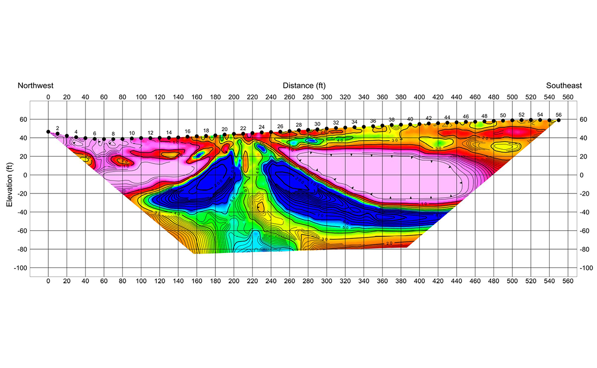
Geosyntec employed conventional and innovative techniques to delineate discontinuous permafrost to support a more comprehensive and representative model than previous base-wide models developed for Eielson AFB. Stable isotope sampling elucidated areas of supra-permafrost groundwater flow distinct from regions free of permafrost. The development of the well inventory identified approximately 6,600 potential well locations using 12 historical sources. After editing and querying efforts, a total of 1,937 of these locations were identified as unique locations of potential wells.
Related Projects

University of New Hampshire and National Oceanic and Atmospheric Administration - Cooperative Institute for Coastal and Estuarine Environmental Technology
Wells National Estuarine Research Reserve, Maine, USA

Los Angeles Department of Water and Power
Los Angeles, California

Preliminary TMDL and Nonpoint Source Pollution Assessment of Coastal Areas in Southern Massachusetts
Massachusetts Department of Environmental Protection
South Coastal Watershed, Massachusetts, USA
County of Santa Barbara
Santa Barbara County, California, USA
Confidential Client
Confidential


