
Featured Projects
Read about our exemplary projects to learn how our consultants work across regions, practices, and markets to deliver exceptional solutions, without exception.


All Projects

Contaminated Sites
Nuclear Metals, Inc. Superfund Site Remedial Investigation and Feasibility Study
Nuclear Metals, Inc. (NMI) used depleted uranium (DU) in the manufacture of penetrators for the US Army. From 1958 to ...

Environmental Management
Pollution Prevention to Reduce Maintenance Costs and Emissions at Robins AFB
Robins Air Force Base [RAFB] was born during WWII as an Army Air Depot, and continues to supply parts for ...

Environmental Management
Environmental Management System for GSA Denver Federal Center
The U.S. General Services Administration (GSA) Rocky Mountain Region manages the Denver Federal Center (DFC), a 640-acre campus hosting 28 ...

Water and Natural Resources
Town Line Brook Stormwater Management Planning and Design
The highly urbanized Town Line Brook watershed contains parts of four coastal towns that were long ago developed on a ...

Water and Natural Resources
Silver Lake LID Demonstration Project
Silver Lake, in the northern suburbs of Boston, is heavily used for recreational purposes such as swimming, fishing, wildlife viewing, ...

Water & Wastewater, Water and Natural Resources
Chicopee River Watershed Assessment
The Chicopee River watershed drains more than 720 square miles of central Massachusetts before joining the Connecticut River, and includes ...

Water and Natural Resources
Low Impact Development Stormwater Designed to Improve Water Quality in Shellfish Habitat in Plymouth Harbor
Shellfishing is a major recreational and commercial industry in southeastern Massachusetts. Among the many threats to its continued viability is ...

Contaminated Sites
Analysis of Subsurface Vapor Intrusion to Indoor Air and Background Conditions near a Former Refinery in Ohio
Trihydro Corporation, a prime contractor to a major integrated petroleum refining company with historic operations across the United States, has ...

Contaminated Sites
Engineering, Permitting, and Construction Services for Biscayne Commons Brownfields Site Redevelopment
The 12-acre Biscayne Commons site was originally part of a "mosquito marsh" along the upper end of Biscayne Bay. The ...

Contaminated Sites
Enhanced In Situ Bioremediation of Groundwater Impacted by Chlorinated Solvents at Intensol, LLC Site
Groundwater below this four-acre former manufacturing facility was contaminated primarily with PCE and TCE, presumably from historic releases at the ...

Contaminated Sites
Innovative Application of Bioaugmentation in a Fractured Rock Environment at New Jersey Naval Air Warfare Center
The Naval Air Warfare Center (NAWC) in West Trenton, New Jersey, was used as a jet engine testing facility from ...

Water and Natural Resources
Massachusetts DEP Nonpoint Source Pollution Guidance Manual and Technology Assessment Resource Tool
In 1993, the Massachusetts Department of Environmental Protection (MassDEP) published the Nonpoint Source Pollution Management Manual, commonly referred to as ...

Contaminated Sites
Engineered Vapor Protection System Allows Brownfields Redevelopment of Closed Landfill as Home Depot Retail Site
Home Depot USA, Inc. (Home Depot) is continually expanding into new territories through development of key property locations that meet ...
Contaminated Sites, Water and Natural Resources
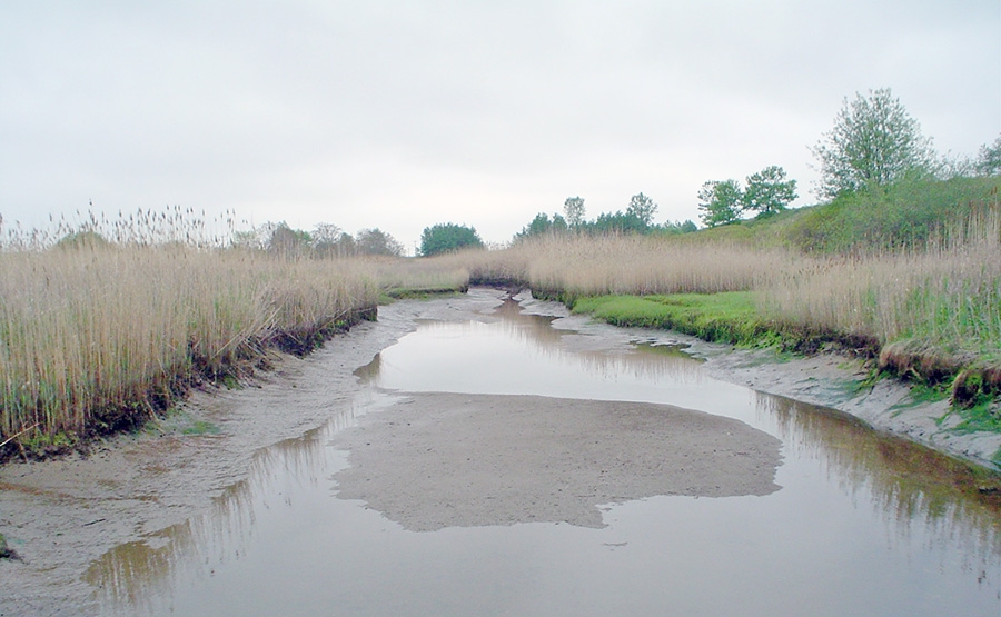
Ballard Street Salt Marsh Restoration
The Ballard Street salt marsh is located just northeast of Boston in a densely populated urban area. In the 1960s, ...

Contaminated Sites, Environmental Management
Environmental Services for Potomac Yard Redevelopment Project
In 2001, Crescent Resources, LLC purchased the 342-acre Potomac Yard site located in Arlington County and the City of Alexandria, ...

Environmental Management
Environmental Compliance Program Support to AT&T Wireless Network
AT&T operates one of the largest wireless communications networks in the United States. With explosive growth in the highly competitive ...

Environmental Management
EMS/Environmental Compliance Auditing and Plant Decommissioning Support to Ford Canada
The Ford Oakville Assembly Complex (OAC) is one of the first to implement flexible manufacturing and deploy a real-time location ...

Contaminated Sites
Targeted Exposure-Point Treatment of Impacted Groundwater Seeps into Tidal Wetlands at Aberdeen Proving Ground
Groundwater in certain areas at Aberdeen Proving Ground is contaminated with a mixture of chlorinated solvents including 1,1,2,2-tetrachloroethane, trichloroethene, tetrachloroethene, ...

Contaminated Sites
Biodegradation of DNAPLs through Bioaugmentation Verified at NASA Kennedy Space Center LC 34 Site
NASA has always been on the leading edge of technology development and application - not only in space exploration, but ...

Contaminated Sites, Water and Natural Resources
Long Pond Watershed Low Impact Development Program for Water Quality Improvements
The Town of Littleton's Clean Lakes Committee obtained a Clean Water Act Section 319 grant from the Massachusetts Department of ...

Water & Wastewater
Innovative Remedy for Perchlorate in Soils and Groundwater at Olin Morgan Hill Site
Olin Corporation (Olin) began signal flare manufacturing operations in 1955 at an 11-acre property located in Morgan Hill, California. Signal ...

Contaminated Sites
Risk Assessment of Potential Subsurface Vapor Intrusion Adjacent to a Manufacturing Plant in the United Kingdom
A former chemical manufacturing plant in the United Kingdom was scheduled for closure in the mid-1990s, and a team of ...

Contaminated Sites
Feasibility Study and Treatability Testing for a Danish North Sea Shoreline Site Impacted by Pharmaceutical and Related Wastes
Kargard Plantage is one of the most widely discussed contaminated sites in Denmark, and is often referred to as a ...

Contaminated Sites
Slurry Wall and Cover System for Redevelopment of the McColl Superfund Site
The McColl Superfund site is a 20-acre former industrial waste disposal facility. From 1942 to 1946, petroleum sludges and other ...

Air Quality, Contaminated Sites
Forensic Analysis of Subsurface Vapor Intrusion to Indoor Air and Background Conditions at a Former MGP Site in New Jersey
A former manufactured gas plant (MGP) site was redeveloped into a multi-unit commercial plaza, and an assessment of the potential ...

Waste Management
Private and Municipal Landfill Gas to Energy Opportunity Assessments in South Carolina for Santee Cooper
Santee Cooper, a leading supplier of electricity in South Carolina, established a "green power" generation portfolio goal of 54 MW ...

Waste Management
Municipal Solid Waste Relocation and Disposal Capacity Expansion Using MSE Wall Technology at Crossroads Landfill
The Crossroads Landfill has been in operation since 1976 to serve the waste disposal needs of Maine residents and businesses ...

Waste Management
Engineering Analyses and Design Innovations Extend Outer Loop Landfill Operating Life
Waste Management of Kentucky, LLC (WMK) owns and operates the Outer Loop Recycling and Disposal Facility in Louisville, Kentucky. The ...

Waste Management
Environmental Monitoring, GCCS and PCS Optimization, and LFGTE/Green Power Project Support at Seminole Road Landfill
DeKalb County, Georgia, part of the urban core of metropolitan Atlanta, owns and operates the Seminole Road Landfill which has ...

Contaminated Sites
Innovative Remedy Application for Groundwater Treatment at Somersworth NPL Site
The City of Somersworth, New Hampshire, operated a disposal site on a 26-acre property from the mid-1930s until 1981. Originally, ...


Climate-Related Risk & Opportunity Assessment for a Retail Store Chain
A large retail store chain was planning to conduct a Climate-related Risk and Opportunity Assessment associated with their current operations ...

Comprehensive Area Plan and Cumulative Impacts Assessment
An oil and natural gas company is committed to sustainable operations and leading its home state’s transition to a low-carbon ...

Marineland Dolphin Adventure FEMA Preliminary Flood Map Appeal, St. Johns County, Florida
Geosyntec prepared a successful appeal of the preliminary Federal Emergency Management Agency (FEMA) Flood Insurance Rate Map (FIRM) ...

Fore Points Marina, Portland, Maine
Geosyntec practitioners oversaw a comprehensive marina redevelopment in a historic location ...

Charleston City Marina, Charleston, South Carolina
Since completing the planning, permitting, design, bidding, and construction administration of a holistic marina redevelopment that was concluded in 1994, ...

Friday Harbour, Innisfil, Ontario
Geosyntec practitioners planned, designed, and helped develop a 700-slip recreational marina on Lake Simcoe just north of Toronto, Ontario. This ...

Green Pond Landing and Event Center, Anderson County, South Carolina
Lake Hartwell occupies 56,000 acres along the South Carolina/Georgia border, is an important environmental resource, and provides a plethora of ...

Four Seasons Resort Coastal Protection Program, Anguilla, British West Indies
ATM, a Geosyntec Company, evaluated and provided solutions for coastal erosion and wave overtopping impacts that occurred along portions of ...
