Geosyntec Consultants Logo

Civil Sites

Base Kodiak Remedial Investigation Field Mobile App

2026-05-05T07:39:30-06:00November 21st, 2024|

Geosyntec developed and deployed a customized off-the-shelf mobile application (app) using ESRI FieldMaps for ArcGIS to allow the field team to navigate to proposed sampling locations, review historical information contained in the project GIS, survey sampling locations, and display the new locations on a dynamic map.

Hartsfield Jackson International Airport Plane Train Tunnel West Extension Surface Instrumentation Monitoring

2026-05-25T14:27:08-06:00November 11th, 2024|

Clark-Atkinson-Technique Joint Venture has designed and is constructing a 900-foot tunnel extension of the existing Plane Train automated people-mover system at the Hartsfield-Jackson Atlanta International Airport in Atlanta, Georgia. The project entailed constructing a vertical shaft and performing tunneling work beneath both the existing terminal and the MARTA and SkyTrain systems.

Design/Build for Railroad Repairs, United States Army Corps of Engineers Norfolk District

2026-04-02T12:09:51-06:00August 25th, 2022|

This design/build project for the United States Army Corps of Engineers (USACE), Norfolk District, at Fort Eustis in Virginia replaced 1760 feet of the railroad, including two timber bridges that spanned tidal wetlands.

Atka Air Force Auxiliary Field FUDS Risk Assessment

2026-04-06T11:55:03-06:00January 5th, 2021|

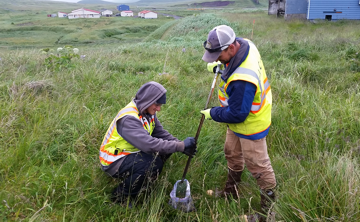
The Atka Air Force Auxiliary Field Formerly Used Defense Site (FUDS) in Alaska was jointly used by the Army Air Corps and the U.S. Navy from 1942 to 1945. The U.S. Army constructed an airfield that became operational in November 1942. Atka was primarily a U.S. Army installation although the U.S. Navy also performed air operations from there and serviced weather stations and submarine cable systems. By late 1945, the base at Atka was largely abandoned. The Atka FUDS required a remedial investigation (RI).

Barge Decommission, Dismantle and Dispose Project

2026-05-26T08:29:43-06:00October 27th, 2020|

The U.S. Army Corps of Engineers (USACE) awarded a $35 million contract to decommission, dismantle, and dispose a nuclear reactor installed on a barge in Texas. A few days after a crane was erected on a single layer of lattice crane mats (and while the crane was stationary) subsidence of approximately 3-1/2” was noted below the west crane mat with no observable subsidence below the east crane mat. The crane was removed and a ground improvement program was implemented including installing dry soil cement mix piers (piers) to improve the bearing capacity. Due to obstructions during drilling, only 75 percent of the piers were installed to the design depth. The project required use of this crane for a period of about one year and its successful deployment was critical.

Design and Permitting Services for Skipjack Solar

2026-04-03T10:35:04-06:00October 23rd, 2020|

Geosyntec was contracted to provide Owner‐engineering support related to erosion & sediment control as well as stormwater management for a 175‐megawatt solar energy facility in Charles City County, VA, owned and operated by a national leader in renewable energy. Geosyntec provided planning, design, and permitting efforts in support of roughly 100 acres of development that included 16 stormwater outfalls. Geosyntec’s portion consisted of two (2) “Pods” out of a total of sixteen (16) that comprise +/‐ 1,100 acres of land disturbance.

Geotechnical Monitoring for the Replacement of the Chickamauga Lock

2026-04-06T13:29:14-06:00November 26th, 2018|

The Chickamauga Lock is a navigation lock on the Tennessee River, seven miles upstream of Chattanooga. Because the existing 80-year-old 60-foot-by-360-foot lock was no longer suitable for the larger barges now used by the transportation industry, the decision was made to replace the lock with a new 110-foot-by-600-foot lock. The new lock makes barge transport more efficient and solves structural issues caused by the existing concrete aggregate. As part of this project, Geosyntec provided geotechnical monitoring during the replacement, maintaining and operating an automated instrumentation and data-management system. This system was used to enhance worker safety while the lock was being installed to monitor the existing lock during construction and to verify structural performance consistent with design expectations.

Full-Scale Field Test of Performance of Levee in New Orleans, Louisiana

2026-05-25T14:11:38-06:00September 19th, 2018|

One consequence of the damage from the Hurricane Katrina storm surge was that the allowable water levels in the repaired canals was reduced relative to pre-Katrina elevations to maximize the potential water storage within the canals during subsequent hurricane events and to minimize the adverse impacts of sustained high-water levels in the canals.

Bolivar Dam Seepage Barrier Wall Construction Data Management

2026-05-26T08:41:10-06:00November 28th, 2017|

Geosyntec acted as the Data Manager of Record for this barrier wall installation. Work included maintaining a geospatial database to compile all project data. Modules included tools to automatically analyse verticality and overlap of excavations from Koden data and generate USACE-approved reports verifying construction.Bolivar Dam on Sandy Creek of the Tuscarawas River in Bolivar, Ohio is a dry dam consisting of two levees within the Bolivar Dam reservoir.

Go to Top